Help
Map Asset Zoom Feature
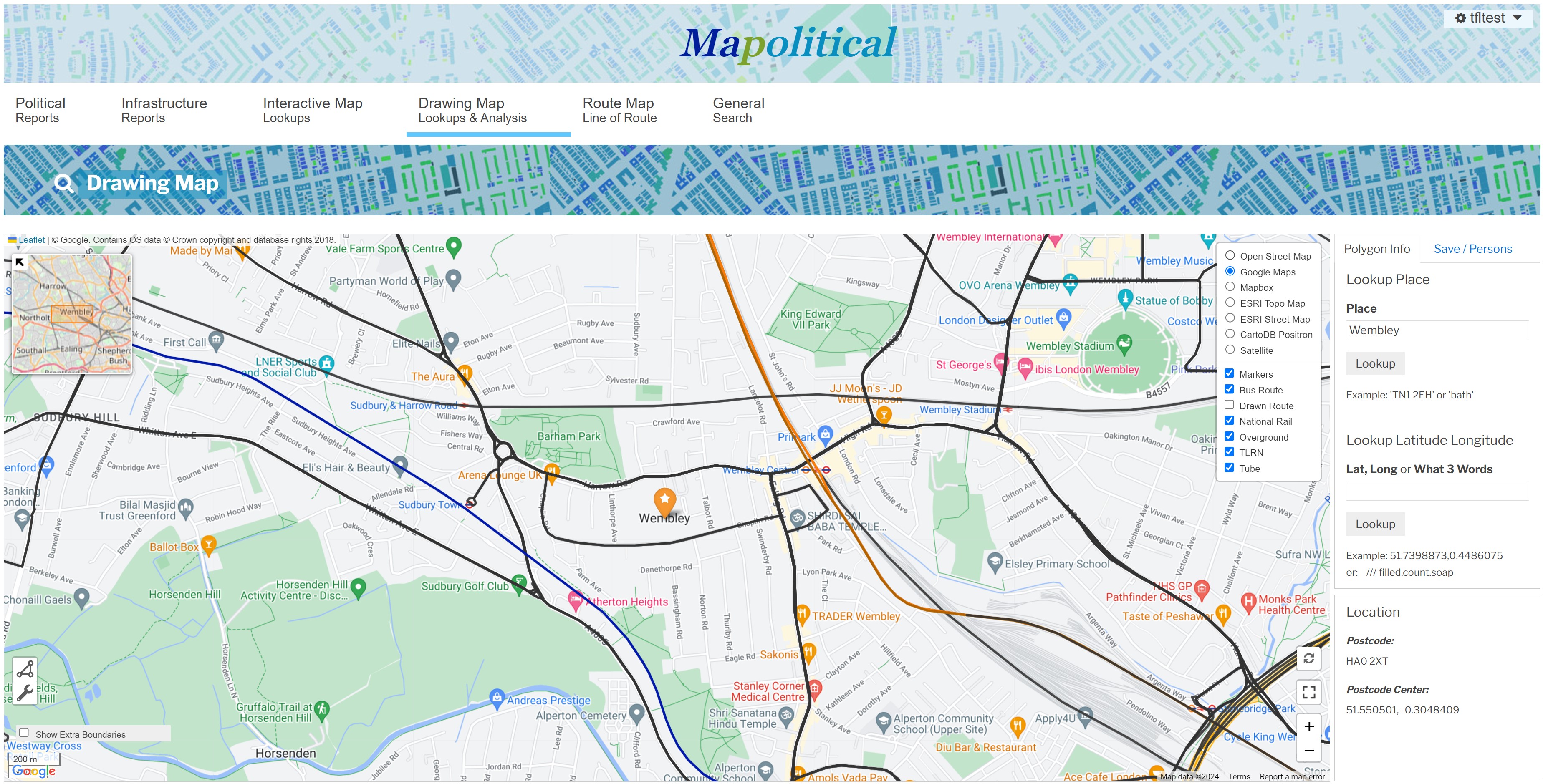
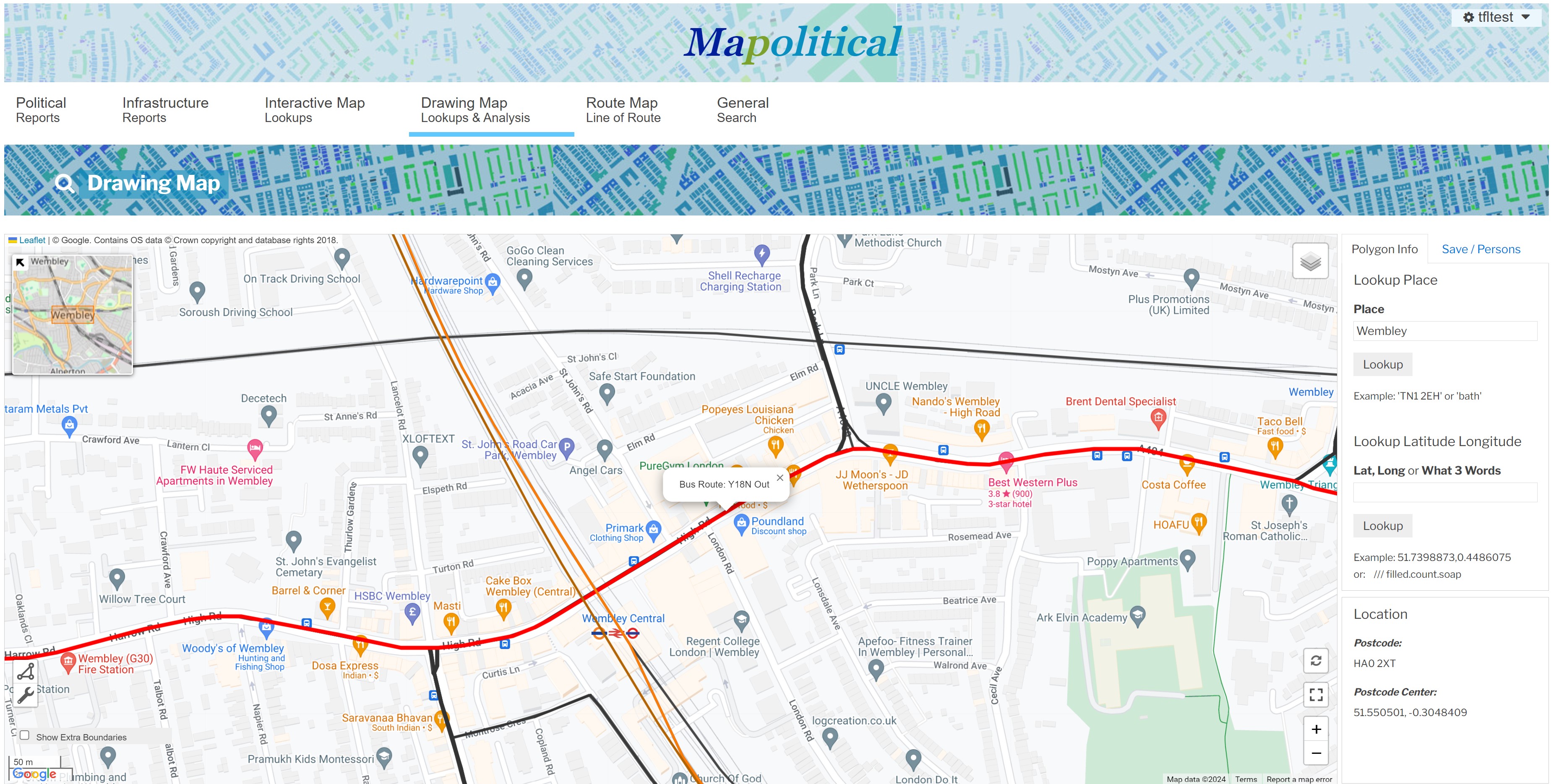
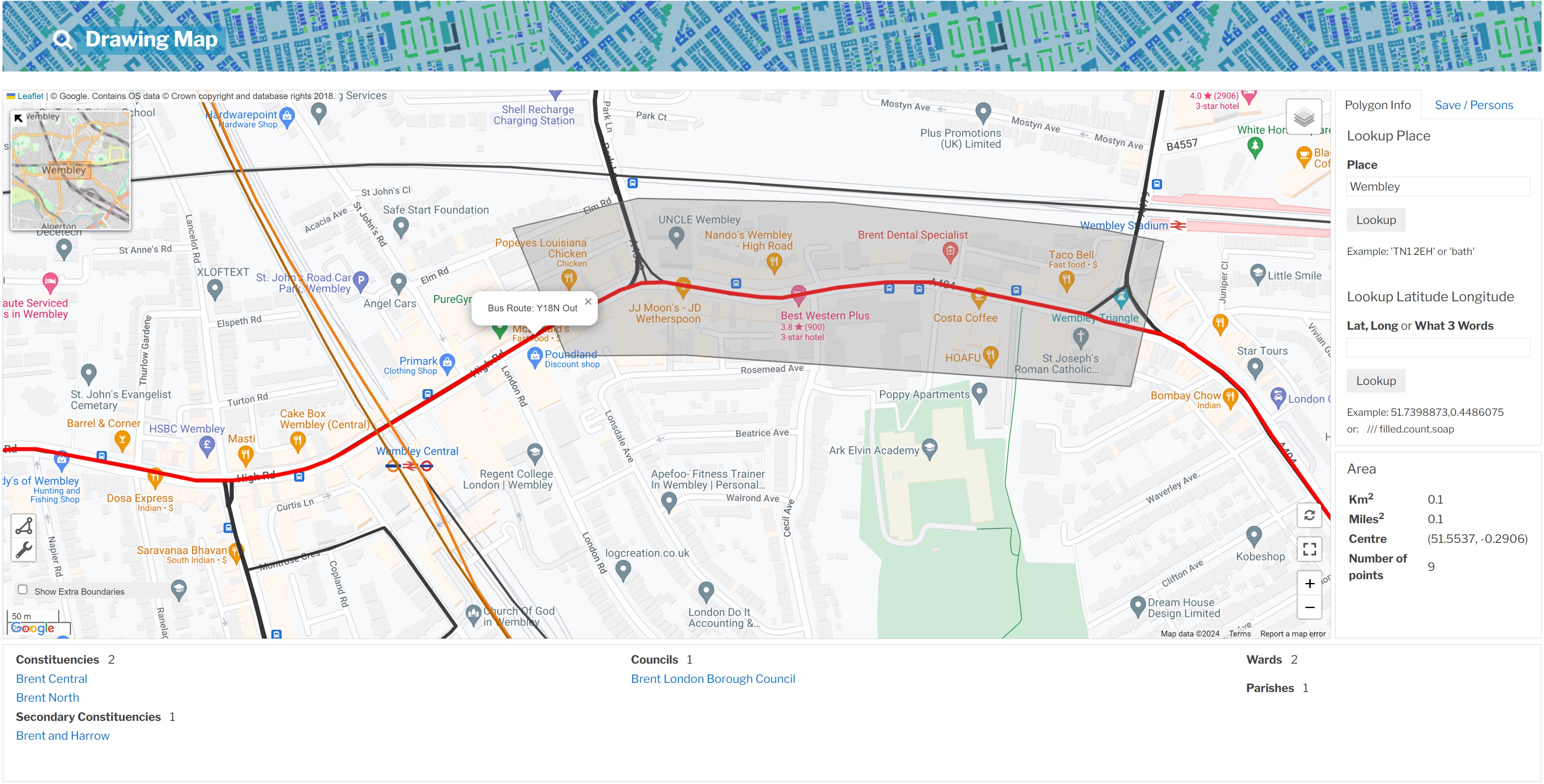
## London Route Asset Zoom Feature Visit any of the main stakeholder maps from the main menu page to access the asset zoom functionality. To assist with TFL projects, this visually shows the TFL assets on the map and allows the existing Mapolitical location plotting, Map Draw or Line of Route to be used while viewing the TFL asset data. It includes the capability to pan around London and view the key transport route infrastructure. We have colour coded the routes (Tube etc) using their official colours where available. The example map below has been zoomed into the Wembley area and shows all found Bus Routes, TLRN routes, Tube lines, Overground routes and National Rail. These can be toggled off/on by hovering the mouse pointer over the top right hand corner of the map and unticking/ticking the relevant asset type boxes (Bus Route etc). ### **Initial Map Zoom**  It is also possible to click onto any line of route to identify it on the map. This map is further zoomed into Wembley and shows where a user has clicked on a bus route - Y18N Out. ### **Selecting a Line of Route**  The Mapolitical stakeholder maps can be used in conjunction with the TFL asset data. As an example, this map shows a user drawn project area around a part of a bus route. On the Interactive Map locations can be plotted and on the Line of Route Map user routes can also be drawn and saved in the usual way. ### **User Drawn Project**  [Return to TFL Route Asset Functionality](./TFL Route Asset Functionality) [Main Help Menu](./index)
About
Privacy
Help
Contact Us