Help
Example Boundary Map
## **Example Drawn Boundary Maps** Please see the example saved drawn boundary below which includes a report below the map which shows all the found administrative boundaries covering Constituencies, Councils, Wards and Parishes. The map will also show the high level associated electoral and administrative boundaries on the map e.g. Constituency, Council etc. These can be toggled on and off of the map using the icon on the top right hand corner of the map and ticking/unticking the boundary name of interest. 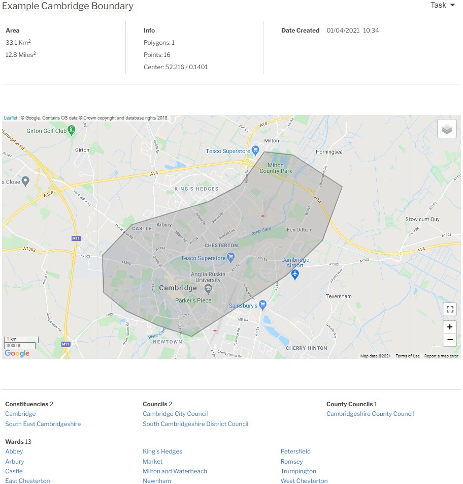 **Multi Boundary Map** Please see the example multi polygon drawn boundary below. Mapolitical can produce a person report from a multi boundary finding all the person contacts across all three boundaries in this case.  [Return to Map Draw Help](./Map Draw) [Main Help Menu](./index)
About
Privacy
Help
Contact Us